
Accurate Survey
INTRODUCTION
WHY OUR GROUP OF COMPANIES IN MIDDLE EAST?
Get things on time with high end quality.
ARCHITECTS, ENGINEERS & CONSTRUCTION COMPANIES KEEP COMING BACK TO US
Because they know what we are doing technically, accurately and affordably on time.
WHO WE ARE
We are a team having more than 60 Surveyors and 20 Engineers. Continuing our standalone reputation for delivery, certainty of outcome is evidenced through 250 major projects successfully completed in alliance with 125 major clients, committed consultants and contractors as business partners in our walk towards Survey industries household name. While we are Seeking latest and sophisticated innovations of engineering technology, we are Committed to meet tar gets of our clients. We have a focused start, to be the market leader and goes pretty smooth because of professional touch to every plan.
ASW has many years of experience in providing quality, professional land surveying and mapping services.
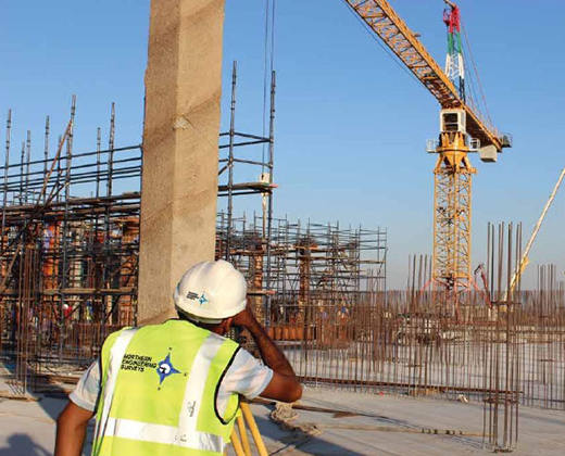
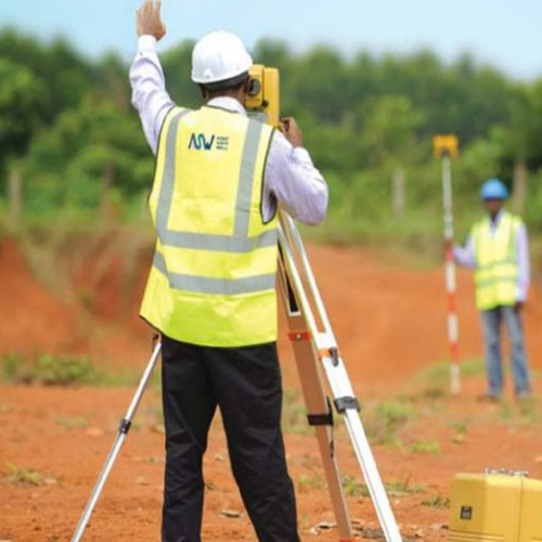
ASW is an industry leaders in land surveys, with many years of experience in providing quality professional land surveying and mapping services. Topographical and measured building surveys are our core business. Since 1994 we have developed competitive and flexible surveying techniques which enable us to quickly and efficiently address clients’ budget and deliver the project on time. Our company offers various services in the field of land surveying, GIS, Road, Canal, Pipe line alignment and Optimization, Bridge alignment and setting out, Control as well Geodetic Survey, Property survey, as Built Survey, Utility Location survey, Cadastral Surveys, Piling surveying works, Landscaping surveying works, Cut fill quantities surveying works, supply of qualified surveyors crews.
We also excel in Topographical survey: Boundary survey, Contour Survey, Residential and Municipal survey, computer aided drawings and data processing using latest software’s.
“We are specialized in producing accurate topographical site surveys at a scale and level of detail to meet our client’s requirements”
WHAT WE DO
Topographical Land Survey
A rigorous measured land survey by Total station and CPS is an excellent starting block for your development. The survey grown through the technology…! Measuring by the tape and looking through the lenses are “very old story”. Now you are getting the area or length or height of your plot from 200km away satellites. We are specialized in producing accurate topographical site surveys at a scale and level of detail to meet our client’s needs. We have a varied range of customers and our land surveyors frequently travel throughout GCC.
Land Survey Applications
Typically our clients require a land surveyor for:
- Proposed housing development site survey: from individual plots to large scale projects.
- Demarcations and gate level computations.
- Preliminary survey for Engineering designs such road planning, metro, coastal defense to reservoir designs.
- As built survey of existing developments and utilities.
- Scanning for Historical building and structures.
- Land Registry Plan and topography.
- Plans for landscape architects and designers.
- Earthwork calculations and cross section preparation.
- Critical setting out for utilities and structures.
.
Quality Assurance
- All GPS and survey work would be carried out with high accuracy.
- All total station Traversing would be closed out on existing known survey stations.
- All spirit leveling would be closed out on survey stations of known elevation.